
Course & pace
Course mapping, GPS and pace of play
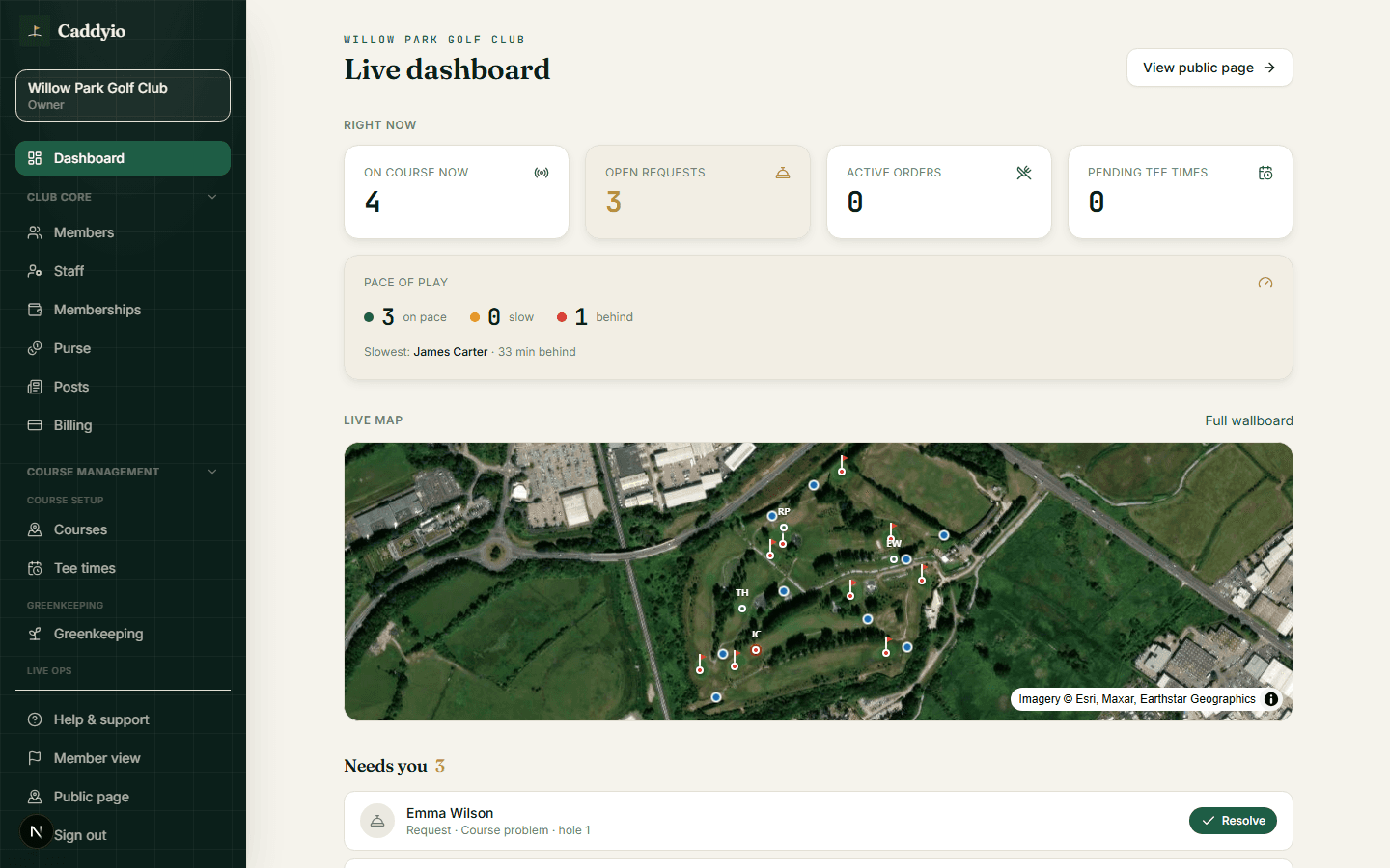
Map your course once and unlock a live satellite view of play: GPS positions on the wallboard, and pace-of-play tracking for your team, so a blind back nine becomes something you can actually see and manage.
A connected club can see its whole course in real time — the foundation for pace, for the wallboard, and for looking after every player out there.

The problem
You can't see the course, so slow play wins
Nobody in the clubhouse can see where players actually are, so bottlenecks build unnoticed and the first you hear of slow play is a complaint. The back nine is a blind spot the moment groups leave the first tee.
The response
See the whole course, in real time
A one-time course map turns member scoring into a live satellite view of everyone out playing — with pace-of-play tracking so your team spots hold-ups early. The same map powers the clubhouse wallboard and on-course service.
Why it matters
What a truly connected club gains
From reactive to proactive on pace
Instead of hearing about slow play in the bar afterwards, your team watches it develop on the map and steps in — a marshal to the right hole, a nudge to the right group.
One map powers everything
Map the course once and it drives the live wallboard, GPS positions, pace tracking and on-course service. It's the foundation the whole on-course experience is built on.
The course as live data
Patterns over time — where rounds bunch up, which tee intervals work — turn marshalling and tee-sheet decisions from guesswork into evidence.
Members feel the difference
Better-paced rounds with fewer hold-ups are one of the most common things members quietly wish for — and rarely get.
From satellite tiles to a surveyed course
Mapping starts from satellite imagery. For the sharpest map and the most precise hole geometry, a drone survey of your course can be arranged as a premium onboarding upgrade — real, high-resolution imagery of your actual holes rather than public tiles.
Map once
Set your course's satellite frame and hole positions in the course-map editor.
A tee box per tee set
Place white, yellow and red separately, so distances are measured from the tee the member is actually playing off.
Pace of play
Your team can track pace and spot developing hold-ups before they become complaints.
Powers the wallboard
The same map drives the live clubhouse wallboard and on-course service requests.
For your club
- See a live satellite view of everyone on the course.
- Spot slow play as it develops instead of hearing about it afterwards.
- Use real pace data to plan tee intervals and marshalling.
- Power the clubhouse wallboard and on-course service from one map.
For your members
- Enjoy a better-paced round as the club manages flow.
- See their round on a real map of the course they're playing.
- Benefit from a club that can see — and look after — the whole course.
- Fewer hold-ups and a smoother day out.
How it works
- 01
Build the map
Set the satellite frame and hole positions once in the course-map editor.
- 02
Play feeds the map
As members score live rounds, GPS positions appear on the course view.
- 03
Manage the course
Track pace, watch the wallboard, and respond to on-course service requests.
The Caddyio difference
An on-course layer traditional club software doesn't have
Established club systems manage bookings and competitions but have no live view of the course itself. Caddyio adds the on-course layer — GPS, pace of play and service — turning the course into something the club can actually see and manage in real time.
Compare the whole platformFrequently asked
- What do I need to do to map my course?
- Set your course's satellite frame and hole positions once in the course-map editor; after that, member scoring feeds the live view.
- Do different tees get their own positions?
- Yes. Each tee set on the card — white, yellow, red — can have its own tee box placed on the map, so a member playing off the reds gets distances from the reds rather than from a single averaged point. Holes you haven't split yet fall back to the one position, so nothing breaks while you work through the course.
- Can I upgrade from satellite imagery to a drone survey?
- Yes. Mapping works from satellite imagery today; as a premium onboarding option, Caddyio can arrange a high-resolution drone survey of your course for pin-sharp imagery and precise hole geometry. See the drone survey feature.
- How does pace-of-play tracking work?
- As members score live rounds, their positions feed the course view, so your team can spot developing hold-ups early.
- What else does the course map power?
- The same map drives the live clubhouse wallboard and on-course service requests.
Related features
All featuresShot tracking
Shot tracking and shot maps from real rounds
Members tag each shot as they play; every one lands on a satellite map of your course. Filter by club for a dispersion view, overlay rounds, and coach from what actually happened.
Learn moreDrone survey
Drone-surveyed course mapping
A professional drone survey of your course — high-resolution aerial imagery and a precise course map that power a stunning clubhouse wallboard and shot-by-shot GPS.
Learn moreWallboard
Clubhouse GPS wallboard
Put a live GPS view of everyone on the course on your clubhouse screen — players moving over a satellite map of your real course, with leaderboards.
Learn moreOn-course service
On-course service and player safety
Members request refreshments, help or report a problem from the hole they're on — and because the club sees where they are, help arrives fast.
Learn more