
Drone survey & 3D modelling · flown worldwide
Your course, rebuilt in 2D and 3D.
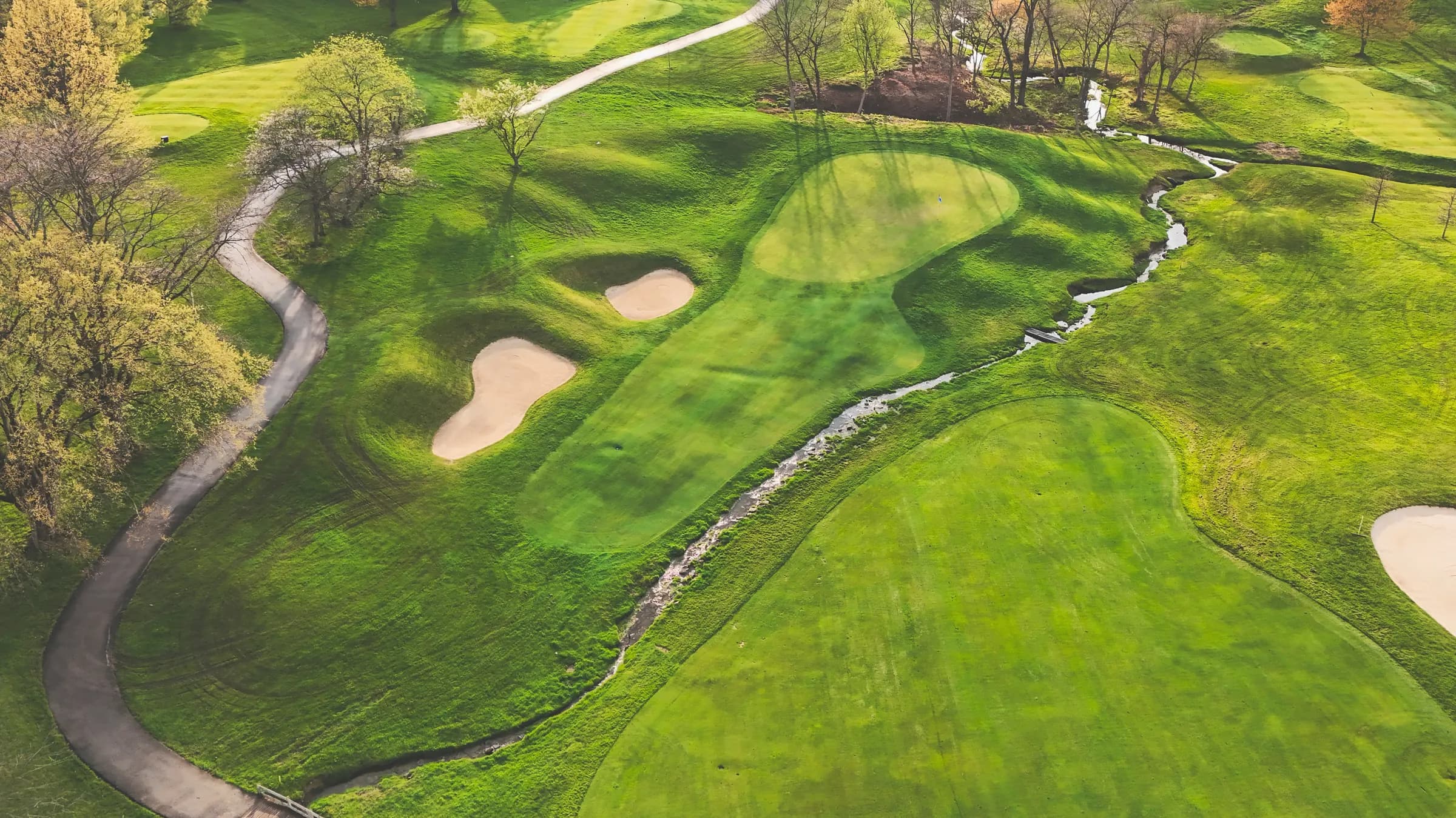
We fly your course with enterprise DJI aircraft and rebuild it as a centimetre-accurate aerial map and a full three-dimensional model — the whole property, and every hole on its own. Wherever in the world it is.
- 1.5–3 cm
- per pixel
- ±3 cm
- RTK accuracy
- 1 day
- on site for 18
- Worldwide
- we travel to you
01 · The flight
An enterprise drone flies your course
A DJI Enterprise airframe flies a planned grid at a fixed altitude, RTK-corrected, shooting overlapping frames on a mechanical shutter. Eighteen holes normally takes a day, out of play hours.
02 · The capture
Thousands of overlapping frames
Every point on your course is photographed from many angles — around 80% forward and side overlap. That redundancy is what lets the software solve real geometry instead of guessing at it.
03 · The point cloud
Photographs become measured points
Photogrammetry resolves the frames into a dense, colour-accurate point cloud: millions of surveyed points with real-world coordinates. Your course, as measurable data.
04 · The 3D model
A textured 3D model of every hole
The cloud is meshed and textured into a full 3D model — greens, bunkering, mounding, tree lines and elevation. Fly it, spin it, section it, measure it.
05 · The deliverables
2D and 3D, whole course and hole by hole
You get a true-to-scale orthomosaic, contour and elevation models, and a separate model for each hole — plus the surveyed map that drives your GPS and clubhouse wallboard.
Deliverables
What lands in your hands afterwards.
Not a folder of photographs. A survey — in the formats your greenkeeper, your architect, your marketing agency and your members' app can each actually open.
In two dimensions
High-resolution orthomosaic
A single, true-to-scale aerial photograph of the entire course, stitched from thousands of frames and geo-referenced. Zoom to a bunker lip without it turning to mush.
Contour & elevation models
Digital surface and terrain models with contours at whatever interval you work in — the shape of the land, separated from what is growing on it.
Measured yardage maps
Tee-to-green distances, carry lines over each hazard and per-tee yardages taken off surveyed geometry rather than a wheel and a guess.
Print-ready course assets
Hole graphics sized for tee signage, scorecards, yardage books, the members' handbook and your website — cut from the same survey, so nothing contradicts anything else.
In three dimensions
A textured 3D model of the course
The whole property as a navigable, photo-textured mesh. Spin it, fly it, drop a section through it, measure anything in it.
A separate model for every hole
Each hole exported on its own, so the greenkeeper, the architect and the marketing team can work on the 7th without loading the other seventeen.
Green surface & slope models
Putting surfaces modelled closely enough to read fall and borrow, and to argue about pin positions with evidence instead of opinion.
The raw point cloud
The measured cloud itself, in the formats your architect, agronomist or drainage contractor already uses. It is your data — you get all of it.
Hole by hole
The whole course — and eighteen separate courses.
One survey produces one model of the property and eighteen models of the holes within it. That matters, because nobody works on a golf course all at once. The 7th green gets rebuilt on its own, photographed on its own, argued about on its own — so it is delivered on its own too.
- 1Par 4 · 324y
- 2Par 4 · 450y
- 3Par 3 · 188y
- 4Par 5 · 506y
- 5Par 4 · 442y
- 6Par 4 · 362y
- 7Par 3 · 154y
- 8Par 5 · 543y
- 9Par 4 · 341y
- 10Par 4 · 363y
- 11Par 3 · 173y
- 12Par 4 · 453y
- 13Par 5 · 495y
- 14Par 4 · 391y
- 15Par 4 · 443y
- 16Par 3 · 170y
- 17Par 4 · 358y
- 18Par 5 · 550y
Illustrative layout. Your grid is generated from your own surveyed geometry, with your hole numbers, pars and measured yardages.
Each hole, on its own
Tee complex to green surround, exported as its own model, map and image set.
Every tee, measured
Yardages per tee set — white, yellow, red, forward — taken off the survey, not averaged from one point.
Comparable over time
Re-fly after work and lay the two models over each other. The change is measurable, not remembered.
What clubs do with it
A survey pays for itself in decisions.
The model is lovely to look at. That is not why clubs buy it. They buy it because the next five years of spending on the course all rest on knowing exactly what is out there.
Drainage & water
See where water actually goes. Elevation models turn the wet corner nobody can explain into a slope you can measure, cost and fix.
Renovation & architecture
Give an architect a surveyed base to design on, put real numbers in a tender document, and hold a before-and-after the committee can see.
Bunker & soil volumetrics
Cubic metres of sand, spoil and topsoil calculated from the model, so quotes can be checked rather than trusted.
Tree management & sightlines
Canopy heights and shade modelling — which trees are costing you turf, and what a fairway looks like once one comes down.
Membership & marketing
Fly-through renders and hole-by-hole imagery for the website, the membership pack and the society brochure. Your course, looking like itself on its best day.
Tournaments & broadcast
Hole graphics, drop zones and spectator routing built on real geometry — the kind of asset a visiting championship expects a venue to already have.
Asset & insurance records
A dated, measurable record of the whole property for planning applications, boundary questions, insurance and storm-damage claims.
Straight into Caddyio
If you run Caddyio, the survey replaces public satellite tiles in your clubhouse wallboard and GPS — pin-sharp imagery of your real course, with players moving across it live.
The kit
Enterprise aircraft, survey-grade positioning.
A consumer drone and a phone app will give you nice pictures. It will not give you a model an architect can build from. The difference is the positioning, the shutter, the flight planning and what happens to the frames afterwards.
Enterprise DJI airframes
DJI Enterprise aircraft — Matrice-series with RTK for full-course work, Mavic 3 Enterprise where a site is tight or noise-sensitive. Mechanical shutters, so a moving aircraft doesn't smear the frame.
RTK positioning & ground control
Real-time kinematic correction on every shot, backed by ground control points where absolute accuracy has to stand up to a contractor's dispute.
LiDAR when photography can't see
Tree-covered corridors and heavy rough hide the ground from a camera. A LiDAR payload gets under the canopy for a true terrain model beneath the vegetation.
Photogrammetry processing
Frames are solved into clouds, meshes and orthomosaics on dedicated processing hardware, then checked by a human against known points before anything is delivered.
- Ground sample distance
- 1.5–3 cm per pixel, set by what the course needs
- Absolute accuracy
- Centimetre-level with RTK and ground control
- Image overlap
- ~80% forward, ~70% side
- Time on site
- A day for 18 holes, around your tee sheet
- Delivery
- Typically two to three weeks after the flight
- Formats
- GeoTIFF · LAS/LAZ · OBJ/FBX/glTF · DXF/SHP · MP4
Typical figures. Every one of them is confirmed for your site in the survey plan before you commit to anything.
How it works
From a phone call to a finished model.
- 01
A 15-minute call
What the course is, how many holes, what you want out of it and roughly when. No slides. We'll tell you on the call if a survey isn't worth it for you.
- 02
Survey plan & fixed quote
A flight plan for your site, the deliverables written down, a date, and one price. Travel, permits and processing included — not added afterwards.
- 03
Permissions & clearances
Airspace, local authority notifications, landowner and operator requirements are arranged before we travel. Where a country requires a locally-licensed pilot, we fly with an accredited local operator.
- 04
Flight day
Usually one day for eighteen holes, planned around your tee sheet — early starts, maintenance mornings, whatever keeps golf moving. Nothing closes for us.
- 05
Processing & quality check
Photogrammetry, meshing and texturing, then a check against control points. If a hole hasn't solved cleanly, we re-fly it rather than ship it.
- 06
Delivery & handover
Files delivered in the formats you asked for, a walkthrough call with whoever will use them, and — if you're on Caddyio — the imagery live in your wallboard and member GPS.
Worldwide
We bring the kit to you, wherever the course is.
Golf is not a British sport with foreign branches, and this is not a British service with foreign exceptions. Travel, freight, insurance, airspace clearance and local operator requirements are handled by us and quoted into one price before you agree to anything.
- United Kingdom & Ireland
- Continental Europe
- Middle East & North Africa
- North America
- Asia-Pacific
- Sub-Saharan Africa
Where local law requires a licensed resident pilot, we fly with an accredited local operator to our own survey plan and processing standard — rather than pretending the rules are optional.
Questions
The things clubs ask first.
Do we have to close the course?+
No. Flights are planned around your tee sheet — usually an early start before the first tee time, or a maintenance morning. We work hole by hole and stay clear of play, and the aircraft is quieter and further away than a greens mower.
How long does the whole thing take?+
Eighteen holes is normally a single day on site. Processing the imagery into finished 2D and 3D models takes longer than the flying: expect delivery two to three weeks after the survey, sooner if you need one specific output urgently.
How accurate is it, really?+
Imagery is captured at roughly 1.5–3 cm per pixel, and with RTK correction and ground control points the model holds centimetre-level absolute accuracy. The exact figures are confirmed for your site in the survey plan, because terrain, tree cover and the accuracy you actually need all move them.
Do you fly outside the UK?+
Yes — this is a global service and travel is quoted into the price. Airspace clearance, local authority notification, insurance and operator licensing are arranged before we come. Where a country requires a locally-licensed remote pilot, we fly with an accredited local operator rather than work around the rules.
Who owns the data?+
Your club does. You receive the deliverables outright, in open formats, to use however you like — including with an architect, agronomist or contractor who has nothing to do with us. If you use Caddyio, you grant us a licence to host the imagery in your own map; that is the extent of it.
Do we have to be a Caddyio customer?+
No. Course modelling is a standalone service and plenty of clubs buy only that. If you do run Caddyio, the survey drops straight into your clubhouse wallboard and member GPS, which is the nicest version of it — but it is not a condition.
What about privacy and people on the course?+
Flights are planned and processed so the deliverable is the course, not identifiable images of members or staff. We work to the data-protection rules of the country we're flying in, and we'll tell you in advance what your club should put on the noticeboard.
What does it cost?+
It is quoted per course, because a flat 18 in Surrey and a mountainside 27 with heavy tree cover are not the same job. Holes, terrain, travel, permits, whether you want LiDAR and whether you want repeat flights all move the number. The call is where we give you a real one.
How often should a course be re-flown?+
After any renovation, and otherwise every two to three years to keep the record current. Clubs working on drainage or turf recovery sometimes fly seasonally, so they can compare the same ground across the year.
Book a survey call
Fifteen minutes on the phone, and you'll know if this is worth doing.
Tell us where the course is and when suits, and we'll call you. You'll get a straight answer on what a survey of your course involves, what it produces and what it costs — including if the answer is “not yet”.
A call, not a form response
A real conversation with someone who has flown courses, in your timezone, at a time you choose.
Anywhere in the world
Travel and permits are our problem. If you have a course, we can get to it.
A fixed quote, in writing
One price covering flight, processing and delivery — before you commit to anything.
Looking at Caddyio for the club as a whole? Book a platform demo instead.